

Forged by Lava, Freed by Revolution, Welcome to Warren Township, Where Only the Land Remembers Everything.
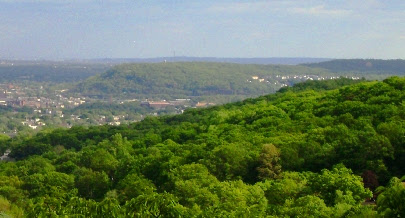
Warren Township is one of those rare New Jersey communities where you feel the weight of history the moment you arrive. Early authors once called it “the greenest place in New Jersey”, and that’s not just poetry. The Watchung Mountains that define its landscape were born 125 million years ago from volcanic lava flows that tilted upward and were slowly carved by water over millions of years, meaning the ridgelines framing your morning commute are essentially ancient geology on display. The Lenape Indians roamed these parts for thousands of years before Europeans arrived, leaving behind little more than arrowheads along the Passaic River and Dock Watch Hollow.
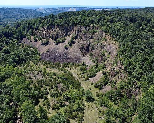
Tucked inside Warren Township, the Lenape word “dogwatcha,” which meant “I am cold,” is associated with this region known for its cool air currents, even on the hottest days. By the Revolutionary War era, it had already evolved into a working hamlet with grain and saw mills humming along Cory’s Brook. Then, in the 20th century, it took on an industrial identity, workers discovered the hollow sat atop ancient basalt, and began quarrying in 1930 after a geological survey identified valuable trap rock deposits, the same lava rock formed 125 million years ago. They began blasting it out of the mountainside for commercial quarrying. At peak production in the 1960s and 70s, workers were drilling into the mountain face and blasting away large sections of rock using explosives. The operation grew so complicated that both Warren and Bridgewater townships actually denied it existed within their borders to avoid regulating it, forcing the state legislature to redraw the municipal boundary line. The quarry is now abandoned, leaving behind a dramatic cliff face that is visible today.
A Founding Story With Revolutionary Fingerprints
The township itself has a founding story with real drama. It was officially created in 1806, carved out of Bridgewater and Bernards, and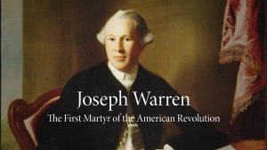 named in honor of Major General Joseph Warren, the hero of the Battle of Bunker Hill. He is considered the first martyr general of the American Revolutionary War. A prominent leader and physician, he was killed in action on June 17, 1775, at the Battle of Bunker Hill.
Several of New Jersey’s own signers of the Declaration of Independence actually voted for Warren’s separation, so this community’s independence has revolutionary-era fingerprints all over it.
During the Civil War period, the region reflected the broader divisions of the nation itself. Many residents served in the Union Army, while others found themselves under scrutiny amid rising political tension. Even civic leaders were affected. County Freeholder Daniel Cory was reportedly detained on suspicion of disloyalty, a reminder that local history was shaped by both unity and fracture.
From Farmland to Fortune
For centuries, Warren remained an agricultural backwater. The population barely moved, dropping from 1,097 in 1875 to just 1,083 in 1920, a township frozen in time while the rest of New Jersey industrialized.
 Then everything changed with the opening of Route 78 in 1986. Easy access to New York City made the land suddenly very valuable. It became too valuable to keep as farmland. The highway didn’t just connect Warren to the rest of the state; it put it on the map for developers and corporations who suddenly saw what farmers had quietly sat on for generations: extraordinarily valuable land within easy reach of New York City. The building boom that followed was staggering; in 1992 alone, the town approved nearly 1000 new homes in a year.
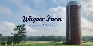
Farmers couldn’t compete with what developers were offering, and one by one, the fields were sold. A township that still had 150 working farms as recently as 1982 watched nearly all of them disappear within two decades. It was swift, irreversible, and entirely human, families making rational choices in the face of life-changing offers. The Wagner Farm Arboretum, the old dairy farm the township purchased in 2001 and lovingly converted into a 92-acre public park, where volunteers grow nearly 20,000 pounds of fruits and vegetables annually for local food banks, stands today as Warren’s quiet tribute to the landscape it used to be before fortune arrived and changed everything.
The Kind of Rich That Doesn’t Need to Announce Itself
That transformation has had a striking financial outcome. Warren Township has been one of the wealthiest communities in the state, which once turned heads nationally for its extraordinary real estate values.
When your land is worth millions per acre for residential development, farming it for crops simply makes no financial sense. Most farm families took the money and sold.
Yet what makes Warren genuinely unusual is that prosperity never fully swallowed its character. The township took a former dairy farm and turned it into a living, breathing arboretum where neighbors grow food for those in need, an act of quiet generosity that says something profound about who lives here.
Just beyond Warren’s border, Washington Rock State Park, perched on the very Watchung Mountains that define the township, served as General George Washington’s actual lookout point during the Revolution, giving him a thirty-mile panoramic view to outmaneuver the British below. You can stand on that same rock today.
No Grid. No Plan. Just the Land.
For a real estate buyer, Warren Township offers something the market rarely delivers: a community that earned its prestige without losing its soul, wrapped in mountains that were ancient before this country was even a thought, genuine history, serious wealth, and just enough open space to make you forget you’re 35 miles from Manhattan.
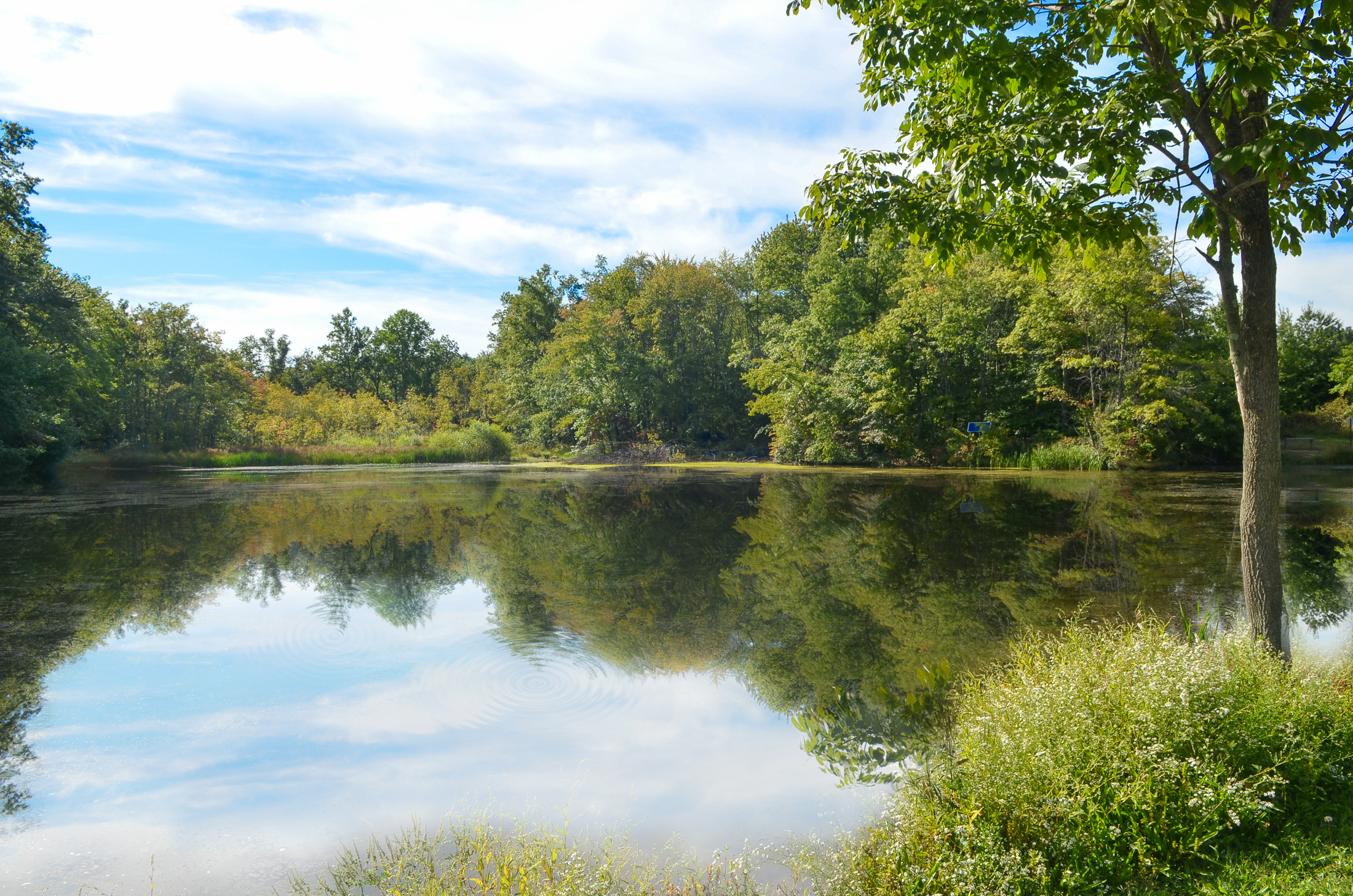
Warren was not built as a planned grid town—it took shape naturally, following the land itself. Its early development was guided by valleys, mountain gaps, and the quiet routes settlers carved between scattered settlements. In this landscape, places like Dock Watch Hollow stand as reminders of what came first: not roads or neighborhoods, but the raw terrain that shaped every path, movement, and decision. It is the land before the town—the geography that settlers had to navigate, adapt to, and eventually build around.


