

THE MOUNTAIN COUNTY
THE HIGHLANDS
New Jersey’s territory rose from ancient seas nearly two billion years ago, forming the state’s oldest geological foundation. Some geologists maintain that the original Appalachian Mountains, of which the Kittatinny Ridge is a part, rose 30,000 feet above sea level, topping the modern Himalayan Mountains, the highest in the world.
A Mountain Preserved Against All Forces “Endless Mountain Kittatinny”
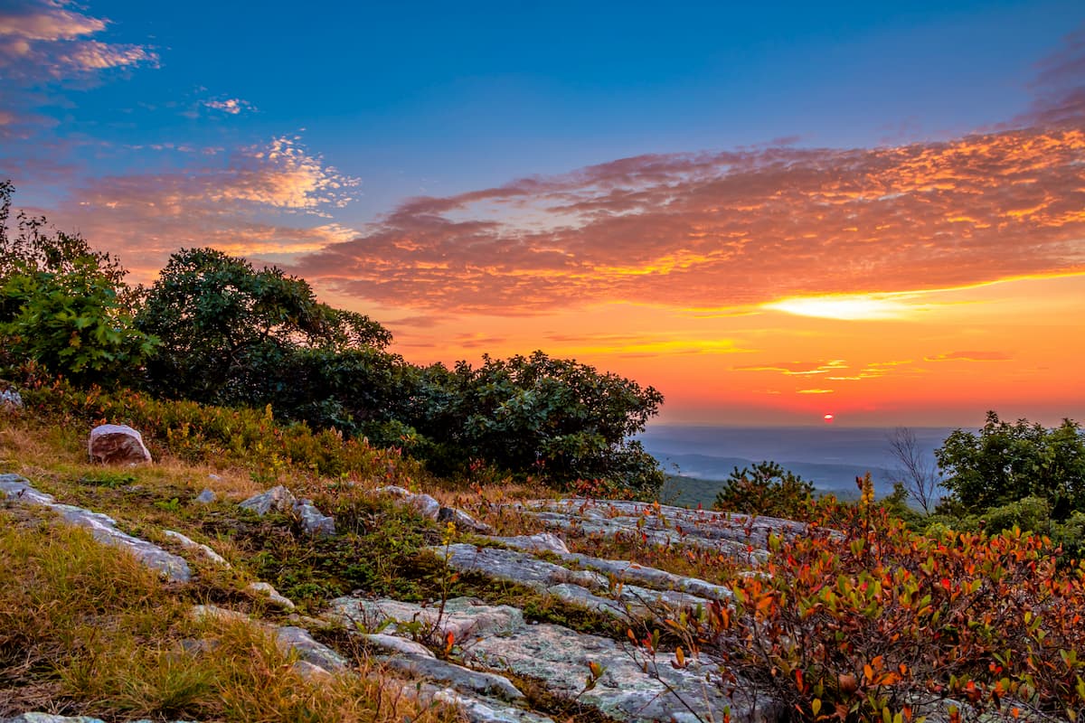
The northwest corner of New Jersey, at the Kittatinny Mountains, named after the Lenape Native American word meaning “Endless Mountain,” has the highest peak of the state of New Jersey in its range, which is High Point at 1,803 feet. Geologically, Kittatinny is closely related to the Shawangunk Ridge in New York, which is essentially part of the same ancient formation. They are not separate stories; They are one long sentence written by the land.
Early settlers, struck by the deep blue cast of the ridge at a distance, called it the Blue Mountains; A name that still lives on across the border in Pennsylvania. As this same mountain spine continues north into New York, it takes on another name: the Shawangunk, the mountain of mist and white stone, appearing and disappearing in fog and light. They rise from the same ancient backbone, formed together hundreds of millions of years ago, then slowly given different voices by time. Together, they show how land doesn’t stop at borders. It evolves. What begins as calm continuity becomes drama and elevation, reminding us that geography shapes identity the same way it shapes communities. Where you stand along this ridge—south or north—changes how the world feels beneath your feet.
U.S. Route 206 traces the eastern edge of the Kittatinny Mountains
If Kittatinny is the endless mountain, U.S. Route 206 is the human response to it; a road that follows the land’s natural rhythm instead of forcing a straight line across it. While Interstate 80 carves through the range at the Delaware Water Gap, Route 206 runs beside it, parallel to the ridge like a quiet companion rather than cutting through it. It was originally built to connect farming and iron-mining communities in northern New Jersey long before the region became a commuter corridor. In the 18th and 19th centuries, it functioned as a colonial trade route linking these towns with markets to the south. Farmers, iron from the Highlands, and goods from mountain settlements were transported along this corridor toward larger commercial hubs.
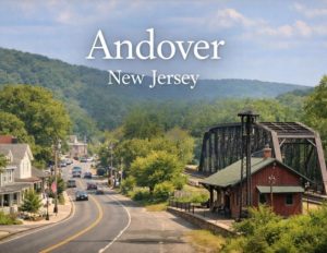 Along its path lie towns such as Andover, Newton, Augusta, Branchville, and Frankford, communities shaped by life in the long shadow of the mountains. Unlike many U.S. highways, Route 206 never had a “parent” Route 6 connection nearby. It was numbered as a spur of U.S. Route 6, but Route 6 itself runs hundreds of miles away in northern Pennsylvania and New York. So Route 206 became one of the rare U.S. highways whose number suggests a connection that geographically never really existed.
Today, the road quietly ties together historic villages, farmland, lake communities, and mountain landscapes — meaning that when you drive Route 206, you’re essentially following a centuries-old economic spine of northern New Jersey.
“Route 206 delivers a rare advantage in today’s market: the tranquility of rural living combined with the convenience of a major regional corridor. For buyers seeking more space, scenic surroundings, and better value, the communities along this route offer an increasingly compelling alternative to crowded urban areas. With straightforward access to major employment centers such as New York City, homebuyers can enjoy a quieter, more spacious lifestyle without sacrificing connectivity—making the Route 206 corridor one of the region’s most attractive opportunities for those looking to live well while staying within reach of the city.”
Copper, Conflict, and Conservation on The Historic Old Mine Road
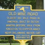 Historic Old Mine Road is a witness to the Dutchmen coming from New York to dig copper just north of Delaware Water Gap in 1650’s. They built a trail to carry their copper to market via Kingston, which became the first long-distance road in the New World. But these small copper-mining efforts in the Minisink region during the Dutch and early American periods met growing opposition from local landowners and early conservation advocates concerned about damage to mountain waters and upland landscapes, including areas near Sunfish Pond along the Kittatinny Ridge. As the ore proved limited, mining declined, helping establish an early pattern of land protection that later preserved the ridge and its natural features.
Where Water Defied the Mountain
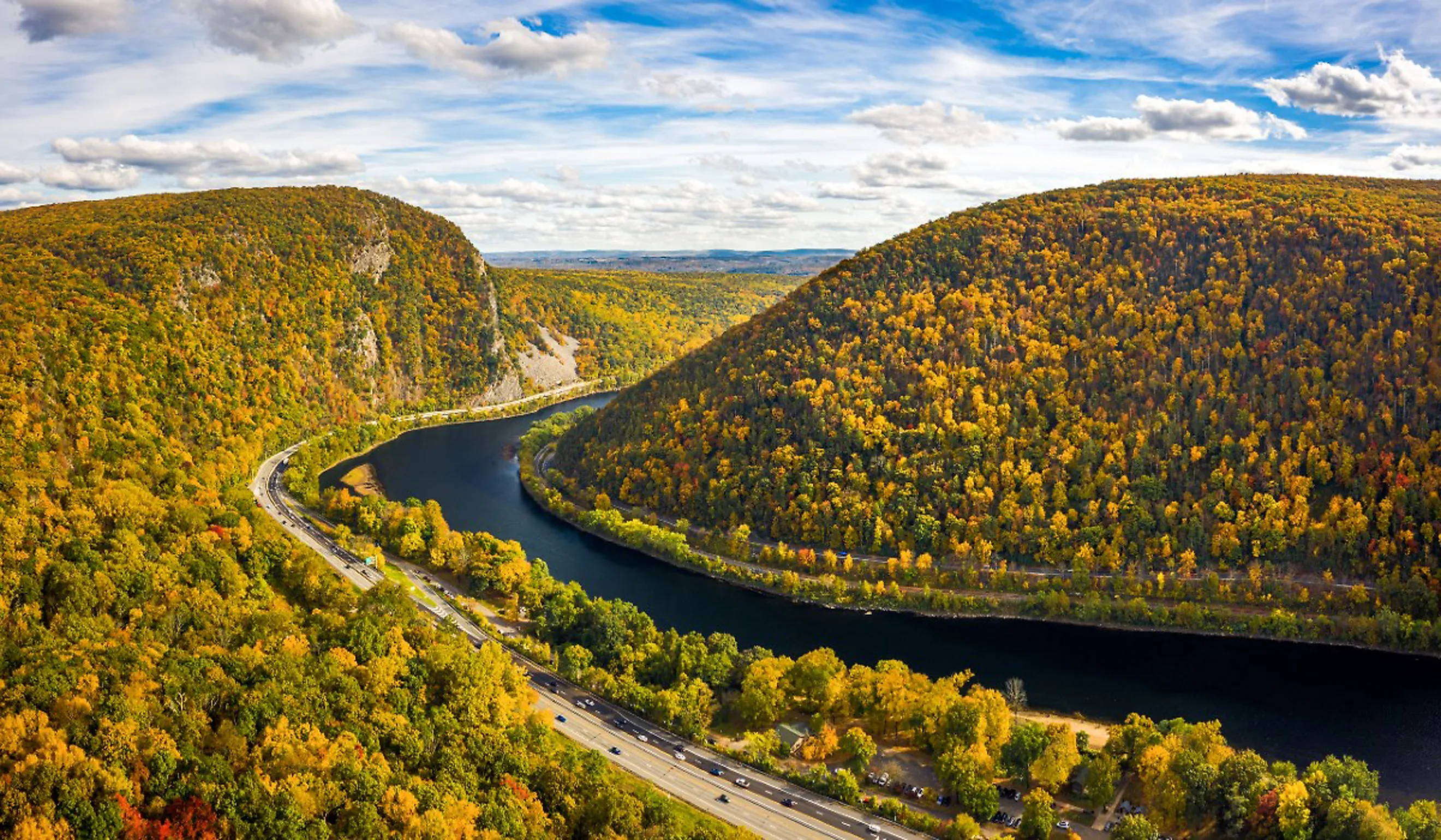
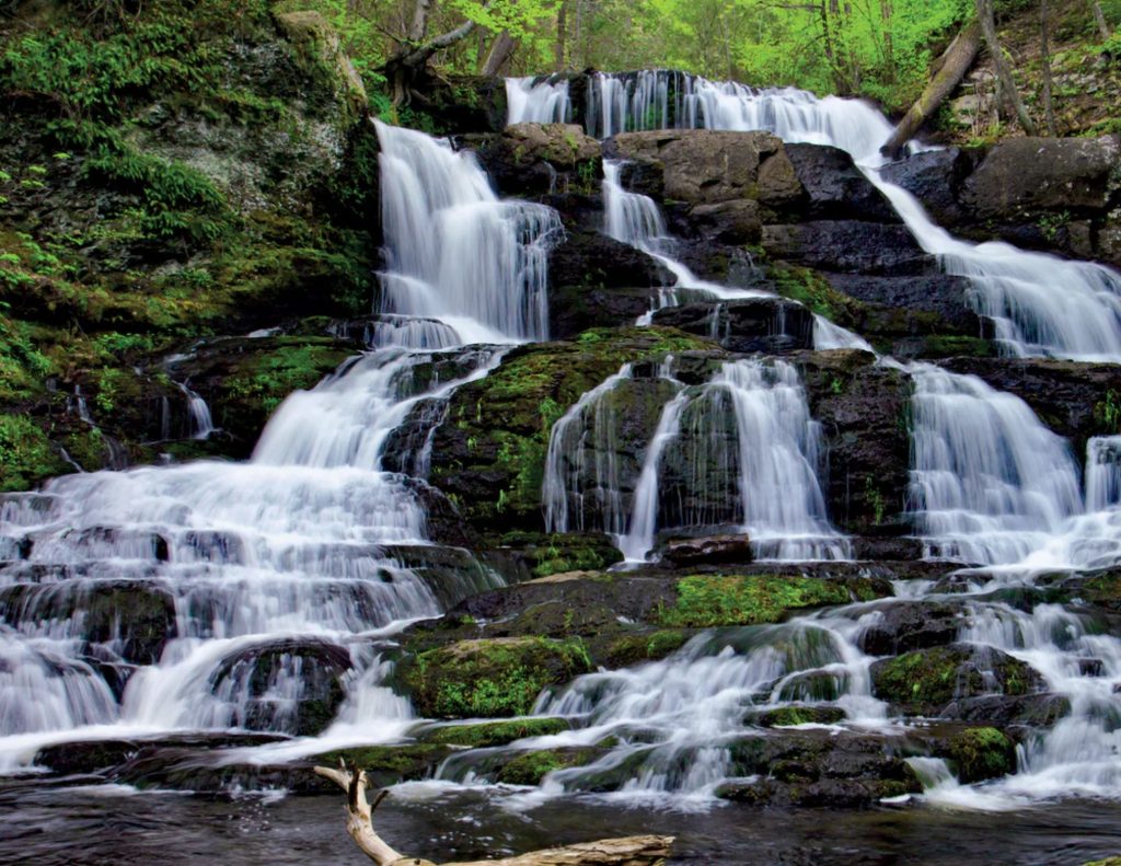
The Delaware River goes straight through the Kittatinny Ridge, carving a deep passage. Geographically, it’s dramatic and rare, and that alone makes it geologically uncommon: the river is older than the mountains themselves, holding its course as the land slowly rose around it. It has been a natural gateway first for native people for centuries, then for settlers, traders, railroads, and highways. It’s the most recognizable break in the Kittatinny Mountains, a visual and symbolic pause in the “endless mountain.” The famous DELAWARE GAP, where the land takes a moment to breathe and lets something pass through.
DELAWARE WATER GAP
In the early 1960s, the U.S. government approved the ambitious Tocks Island Dam project along the Delaware River, just north of the dramatic Delaware Water Gap. The plan called for a massive dam that would create a 40-mile reservoir intended to control flooding, supply water to growing cities like New York City, and generate hydroelectric power.
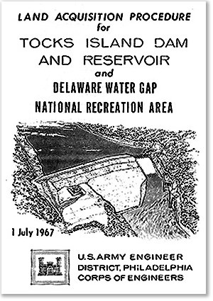 To prepare for the project, the federal government acquired more than 70,000 acres of land and forced thousands of residents to relocate, emptying historic rural communities that had existed for generations. Villages such as Walpack Center were largely abandoned, leaving behind quiet roads, old churches, and farmsteads that seemed frozen in time.
It happened about 300 years later than mining efforts; the same valley became a battleground between conservationists and the US government. The Army Corps moved in and bought properties with a goal to build a giant dam in the Delaware River. Conservationists convinced the states of New Jersey, New York, and Pennsylvania that it would bring a disaster to nature if they did so, and those states all voted in 1975 against building the dam. Federal officials were forced to set aside the plans for the reservoir.
Instead of being flooded, the valley was preserved as the Delaware Water Gap National Recreation Area, transforming what was once a contested development project into one of the most protected and scenic natural landscapes in the Northeast—where forests, trails, and hidden remnants of vanished villages still tell the story of a valley that almost disappeared beneath water.
With all this said, Kittatinny is mainly composed of quartz, which makes the mountain extremely resistant to weathering. It endures in quiet strength, its forests and stone holding steady through time—destined to remain calm and undisturbed for centuries. This timeless landscape does more than inspire awe; it shapes the character, desirability, and long-term value of the homes and communities nestled in its shadow. In real estate, natural permanence like this is not just scenery—it is stability.


